Use precise data to maximize time, control costs, utilize assets, and keep drivers safe.
Streets
Improve distance and drive time estimates down to the last mile.
- Eliminate unknown miles and save time on the road
- Provide drivers with accurate turn-by-turn driving directions
ADDITIONAL LICENSING APPLIES
Tolls
Calculate the true cost of a lane with toll fees itemized and tallied for each route.
- Generate precise toll costs based on a vehicle's weight, dimensions, axle count, and trailer count, as well as day of week and time of day
- Determine the most effective trip plan for your business by comparing mileage reports and toll costs
Traffic
Generate accurate transit times and ETAs using current and predictive traffic data, powered by INRIX®.
- Improve asset utilization and ensure HOS compliance with precise drive times based on actual traffic congestion
ADDITIONAL LICENSING APPLIES
Weather
Get proactive alerts when your route plans are scheduled to travel through impactful weather conditions.
- Make critical decisions about routing drivers around hazardous areas
- Notify drivers and customers of potential delivery delays
ADDITIONAL LICENSING APPLIES
HazMat
Ensure compliance and keep assets safe on legal roads when hauling hazardous materials.
- Plan in accordance with Department of Transportation, nationwide HazMat, and nationwide dangerous goods regulations
ADDITIONAL LICENSING APPLIES
Energy
Calculate accurate travel times, mileage and distances to and from wells, well to well, or from public to private oil and gas lease roads when operating in the patch.
- Use satellite imagery to view well heads, facilities, and other off-road data
- Plot and save custom latitude and longitude coordinates for precise routing to specific locations
ADDITIONAL LICENSING APPLIES
Worldwide
Global routing, mileage, and driving directions in 240 countries around the world.
- Consistent with the U.S. Department of Defense and General Services Administration distance compliance for approved freight rating and billing
ADDITIONAL LICENSING APPLIES
Spreadsheets
Access formulas and data within Microsoft® Excel® for fast calculations and customizable analysis.
- Summarize and analyze your data, including price quotes, driver pay, lane analysis, and freight bill auditing
- Easily populate a mileage database without additional software programming effort
- Requires a base installation of PC*Miler
ADDITIONAL LICENSING APPLIES
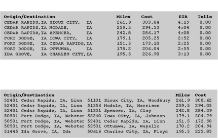
BatchPro
Quickly calculate miles and cost estimates from large volumes of origin and destination pairs.
- Enhance returned data by specifying routing type or incorporating toll and traffic data
- Pairs can be input as city/state, zip code, or latitudes/longitudes
- Requires a base installation of PC*Miler